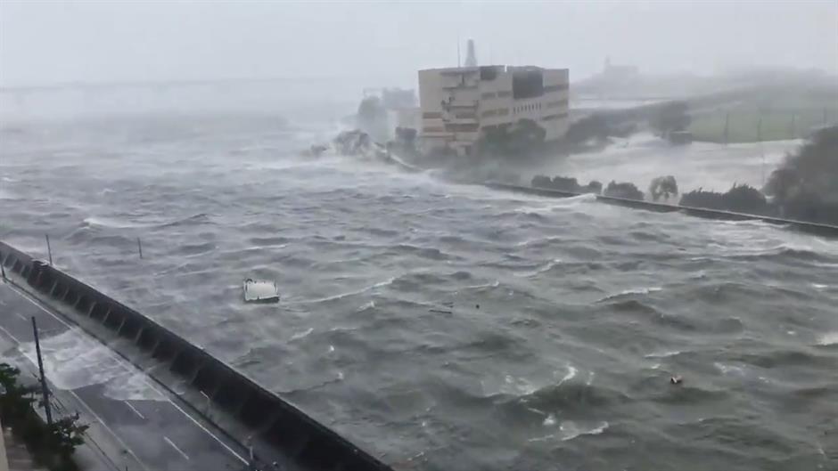
One of Japan's largest airports was swamped and a tanker crashed into a road bridge as the strongest typhoon to make landfall in Japan in 25 years hit the country's southern prefectures, causing storm surges and lashing buildings with heavy wind and rain.
Oglas
Typhoon Jebi landed with "very strong" force in Tokushima prefecture early afternoon local time, the strongest typhoon to hit the country since 1993, said Akihiro Kikuchi, from Japan's Meteorological Agency.
Japan Coast Guard spokesman Keita Sakai said that an 89m-long tanker, the Houunmaru, had been pushed by the strong typhoon winds from its anchorage at sea into the road bridge connecting Kansai Airport with the mainland.
Images from state broadcaster NHK showed the bridge of the ship embedded in the structure.
https://twitter.com/NHKWORLD_News/status/1036873267649236992
Eleven crew members were on board, but no one was injured in the incident, Sakai said.
The typhoon's centre made landfall again near Kobe City around 2.00 p.m. local time (1.00 a.m. ET).
https://twitter.com/EarthUncutTV/status/1036813254884900864
Hundreds of domestic flights were cancelled, along with international flights from Kansai Airport in Osaka.
Both runways were closed and later swamped with storm surges that caused record tides in Osaka Bay. Water was also rising near the coastal city of Kobe, Japan's Meteorological Agency said.
Flight cancellations also affected Itami Airport in Osaka and Chubu Centrair International Airport in Nagoya.
As the typhoon continued to batter Japan's main island of Honshu, nine cities and towns had issued compulsory evacuation orders. A further 53 had issued non-compulsory evacuation orders. Almost 5,000 refuge zones, mostly town halls and school gyms, have been set up.
A total of 13,913 residents have been moved to the evacuation centres, according to the Fire and Disaster Management Agency.
Before it made landfall, the storm had sustained winds of 140 km/h (87 mph) and gusts of 165 km/h (102 mph), the equivalent to a Category 1 Atlantic hurricane.
https://twitter.com/EarthUncutTV/status/1036809796614217729
There is a significant threat of widespread flooding. Jebi has dumped over 500 mm of rain in some areas and is likely to produce between 150 and 300 mm of rain in many locations.
Jebi comes just weeks after Typhoon Cimaron, which moved over the same region just weeks ago.
Kakvo je tvoje mišljenje o ovome?
Pridruži se raspravi ili pročitaj komentare
Oglas
Kakvo je tvoje mišljenje o ovome?
Pridruži se raspravi ili pročitaj komentare
Oglas
NAJČITANIJE
Oglas
Oglas
Najnovije
Oglas
Oglas


 Srbija
 Bosna i Hercegovina
 Slovenija


