


 Srbija
 Bosna i Hercegovina
 Slovenija


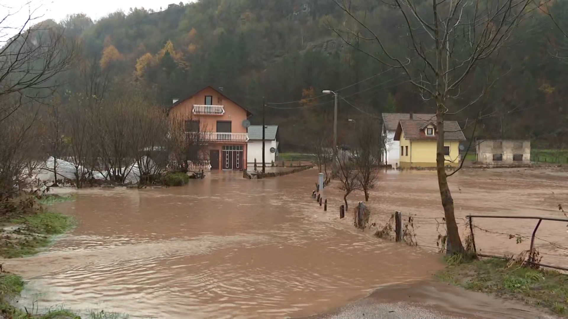
Dron.ba team’s areal footage of the Sarajevo valley best shows the magnitude of the floods that have hit the Sarajevo Canton, caused by the relentless rain over the past 2 days.
Some of the most critical regions, such as the highway on the entrance to Sarajevo and the Municipality of Ilidza, situated right next to the Bosnian capital were shot from the air.
Snimci iz zraka poplava na autoputu na ulazu u Sarajevu pic.twitter.com/OHOFcjbejV
— TV N1 Sarajevo (@N1infoSA) November 5, 2021
Snimci iz zraka poplava na autoputu na ulazu u Sarajevu pic.twitter.com/OHOFcjbejV
The rain that fell over the past two days caused the river Zeljeznica to overflow its riverbed, flooding the Municipality of Ilidza and the surrounding settlements.
Snimci iz zraka poplava na Ilidži, naselje u potpunosti potopljeno pic.twitter.com/MZZSBVQEeb
— TV N1 Sarajevo (@N1infoSA) November 5, 2021
Snimci iz zraka poplava na Ilidži, naselje u potpunosti potopljeno pic.twitter.com/MZZSBVQEeb
The most critical situation is in Otes, near Ilidza, where houses, cars and other facilities were flooded and residents evacuated. That past of the Sarajevo Canton is still without electricity.
Spašavanje bebe u naselju #Otespic.twitter.com/omkEFt506X
— TV N1 Sarajevo (@N1infoSA) November 5, 2021
Spašavanje bebe u naselju #Otespic.twitter.com/omkEFt506X
The power outage was caused by a breakdown at several substations in some parts of the city, while in others it was turned off as a precaution.
The situation was also critical in the municipality of Trnovo where hundreds of houses were flooded, farms were destroyed and many locals were evacuated.
The rain in the Sarajevo canton continues to fall.
Kakvo je tvoje mišljenje o ovome?
Pridruži se raspravi ili pročitaj komentare


Kakvo je tvoje mišljenje o ovome?
Pridruži se raspravi ili pročitaj komentare